
 How to survive a power outage in winte
 Monarch Butterflies That Should Have Migrated South Have Yet to Leave Canada
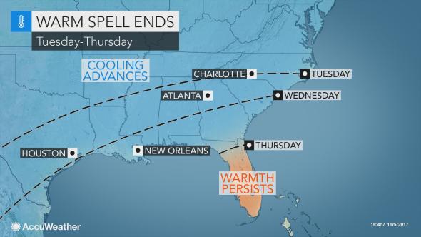 Rain, cooler air to sweep record-challenging warmth out of southern US this week
 Franken-Philippe Bringing Damaging Winds
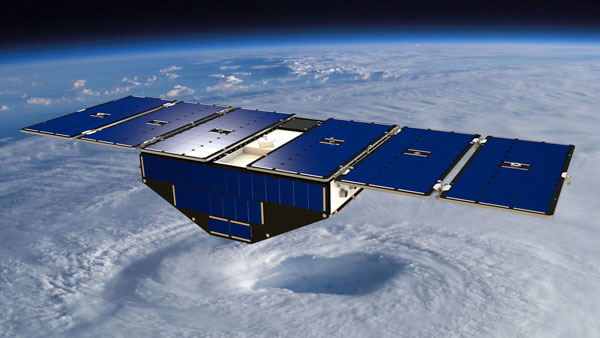
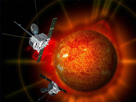 Exploring Solar Storms
 Tropical Storm Philippe Drenches Florida and Cuba
 Hole in the ozone layer over Antarctica
 The history of the barometer
'Big Weather Changes You Can Expect in October
At a Glance
- In October, there are several key changes you typically see in the weather.
- These include seasonal first snowfalls and freezes.
- One U.S. state's hurricane danger typically peaks in October.
- In recent years, there have also been some big October storms.
October weather changes in the U.S. typically result from increasing contrasts in temperatures because of diminishing daylight and a southward migration of the jet stream from its late-summer vacation in or near Canada.
But not all of these changes are related to colder air.
Some aspects of October weather worsen wildfires. Another typical shift makes one U.S. state's hurricane threat higher in October than any other month.
Here are six typical changes we see during the first full month of fall.
1. First Freeze
In October, the season's first 32-degree low temperatures begin to migrate from the high country of northern New England, the Rockies and areas near the Canadian border into much of the interior Northeast, Great Lakes, Midwest, northern and central Plains, and High Plains of the Rockies.
This includes areas as far south as the Smoky Mountains of Tennessee and North Carolina, parts of the Oklahoma and Texas Panhandles, and northern New Mexico.

Typical date of the first freeze of the season, based on National Weather Service 30-year average data.
2. Fall Foliage Peak
Given all those crisp, cool nights, October is when the large majority of the Northeast, Midwest and West sees the best, most vivid fall colors.
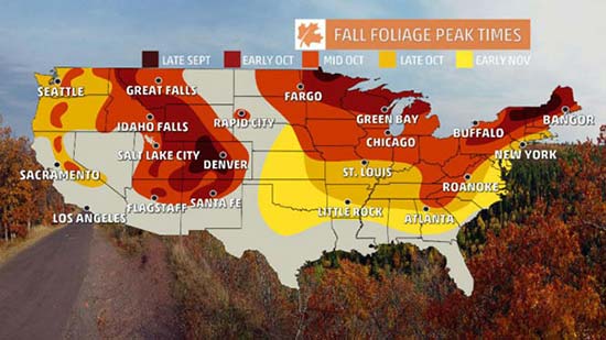
Typical time of peak fall colors. Much of the Northeast, Midwest and West see peak colors in October.
First Snow
With this increasingly cold air, accumulating snow previously restricted to the highest peaks of the Rockies and Alaska in September begins to blanket lower elevations of the High Plains, parts of the northern Plains and northern Great Lakes, Appalachians, Adirondacks, Green and White Mountains in October.
Some cities that typically see their first measurable snow in October are Caribou, Maine; Marquette, Michigan; Duluth, Minnesota; Bismarck, North Dakota; Great Falls, Montana; Denver; and Anchorage, Alaska.
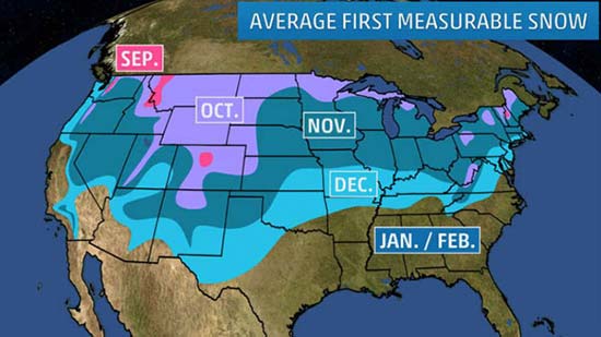
Month of the average first accumulating (0.1 inch or greater) snowfall of the season, according to 30-year average statistics.
4. October Storms Can Be Major Events
Superstorm Sandy in 2012 was the ultimate recent example of a massive October storm. One of Sandy's unique impacts was its feet of snow burying parts of the Appalachians.
But there have been a number of other recent big October storms:
- Early October 2013: Winter Storm Atlas, hammered the High Plains with blizzard conditions
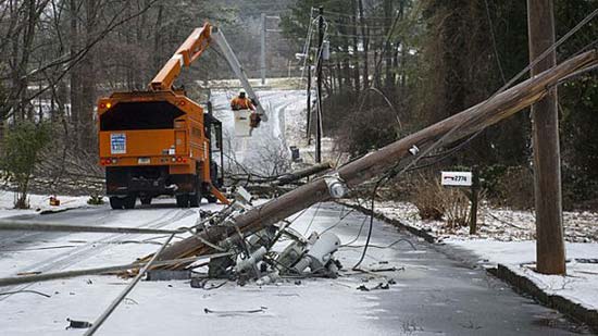
- Late October 2011: The "Snowtober" storm knocked out power to over 3 million in the Northeast.
- Late October 2010: The "Octobomb" storm set all-time low pressure records in Minnesota and Wisconsin, and spawned severe thunderstorms and tornadoes in the Ohio Valley and Mid-South.
- Mid-October 2006: Heavy lake-effect snow damages many trees, knocks out power to one million customers in Buffalo, New York.
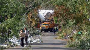
Local residents watch as crews clear fallen trees Oct. 16, 2006, in Amherst, N.Y., a suburb of Buffalo, N.Y.
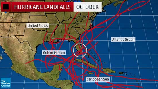
5. Hurricane Peak Threat in Sunshine State
September may be the peak month for hurricanes in the entire Atlantic Basin, but in Florida, October is a month feared just as much.
From 1851 through 2016, 32 hurricanes made a Florida landfall in October, dwarfing the state with the second-highest number of October landfalls: Louisiana, with nine.
In South Florida, October is the month with the most hurricane direct hits. According to NOAA's Best Track Database, 23 October hurricanes have passed within 100 nautical miles of downtown Miami since 1851.
Over the past two Octobers, we've seen Hurricane Matthew rake up the coast from Florida to the Carolinas, preceded the previous October by Hurricane Joaquin raking the Bahamas as historic flooding swamped South Carolina.
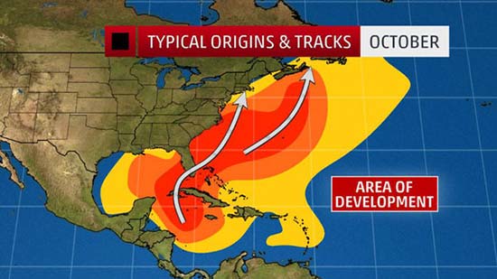
These are the typical areas for development and tracks of Atlantic Basin tropical cyclones in October.
6. Santa Ana Winds Return
Southern Calfornia's infamous offshore winds, known as Santa Ana winds, typically kick into gear by October, according to a 2017 climatology study.
Fueled by a combination of high pressure in the Great Basin and the southward return of the jet stream, these hot, intense winds squeeze through passes and canyons of the L.A. Basin, at times, from fall through spring.
What makes them particularly dangerous in October is that they occur when soil moisture is at its driest after the summer dry season. These Santa Ana winds can whip either an existing wildfire or just-developed small brush fire into an inferno.